Our Talk in June given to us by Environment Agency was well received allowing plenty of questions and answers on the night.
Andy Charlesworth, Asset Performance Advisor and George Fletcher, Deputy Catchment Engineer gave an informative talk focusing on our River Freshney and flooding risk mitigation due to climate change.
The Environment Agency’s responsibilities include:
- Managing flooding risk from main rivers, reservoirs, estuaries and the sea
- Regulating major industry and waste
- Treating contaminated land
- Water quality and resources
- Regulating fisheries
- Inland river, estuary and harbour navigations
- Conservation and ecology
Environment Agency have permissive powers to carry out maintenance work to maintain flood an coastal risk management[1]. The responsibility to maintain main rivers and ordinary watercourses ultimately falls to the riparian landowner[2].
Most of us have seen flood risk maps for our area and some had the misfortune to experience the 2007 major flooding around the Freshney’s banks. 2019 saw torrential rain in both June and November causing flood alerts. In fact GCDCS was due to receive an Environment Agency representative to give us a talk on November 7th that year but had to cancel at the last minute due to the Agency being on 24hr flood alert! In recent years £20 million has been spent to protect 14, 000 properties at risk from flooding from the Freshney. As for the coastline and flooding from the sea, responsibility is shared between ABP, Environ Agency and councils depending on where the risk lies. Incident Response, the alarms and computerised warning signals are the future. The 18 warning sirens put in place in 2006 are now decommissioned, warnings instead to be given via a choice of landline or mobile, text, email and automated call.
However, to ensure you get your warning of impending disaster you need to sign up for them via https://www.gov.uk/sign-up-for-flood-warnings
History of the Freshney
From a series of springs, it flows through Laceby as Laceby Beck, a natural channel at a gradient after which there is no gradient between Great Coates and Freshney Tilting gate. Diversions towards improvements in flow since 17th century leaves us with where the Freshney is now and with the New Cut alongside adjacent to Great Coates Road.
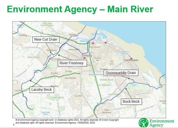
1960s saw the construction of flood walls – amid lots of other proposed schemes. One which was definitely constructed was that along New Haven Terrace and Duke of York Gardens. In the 1970s to prevent tidal damage along the Freshney, ABP installed a cut off wall with Archimedes screws at Grimsby’s Riverhead. Even so, 1981 saw 300 homes suffer flooding when it was found that Flottergate Sluice at Haven Bridge caused constriction in the channel and it was removed.
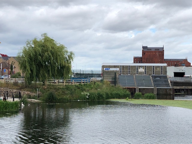
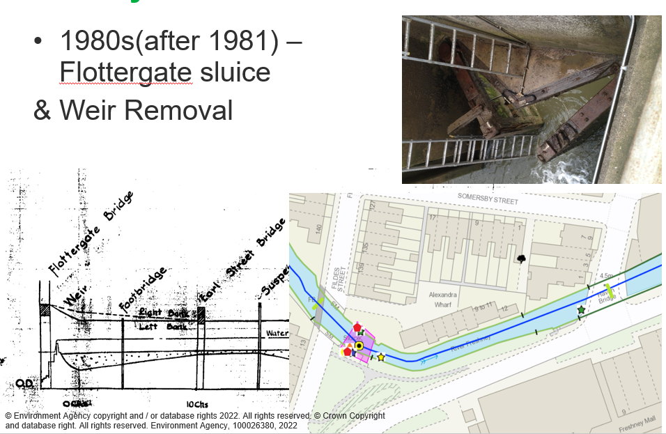
Flottergate Tilting Weir in action today:
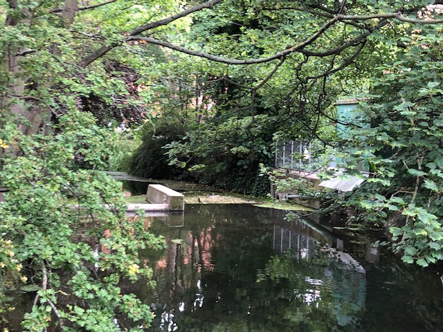
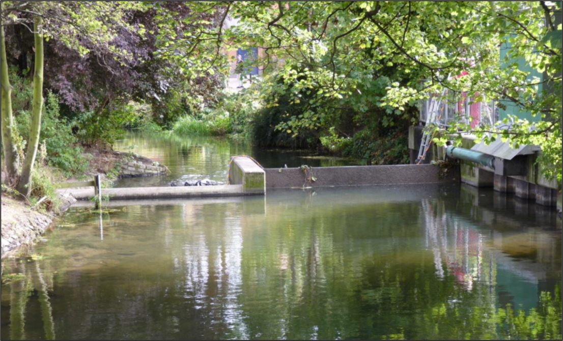
NB Images taken from New Cartergate footbridge. Who'd believe such a 'rural scene' is in the centre of Grimsby!
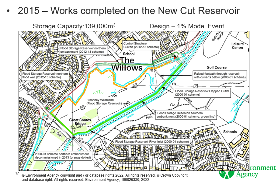
The 2007 flooding of 90 properties in the Willows Estate area normal monthly rainfall was 53mm and from 1st June to 1st July of that year there was 263mm with 65mm falling in the 24hours of Sunday 24th to Monday 25th. In 2015 the New Cut Reservoir was constructed with a storage capacity of 139,000m3 – the idea being that instead of walls and other physical defences, water with a potential to flood homes will instead overflow into a designated holding area and dissipate.
Monitoring by level sensors was definitely valuable in averting catastrophe during record levels of water in November 2019 when between 4th – 18th the recorded levels of River Freshney rose by 10 points allowing for both flood warnings and protective measures to be made.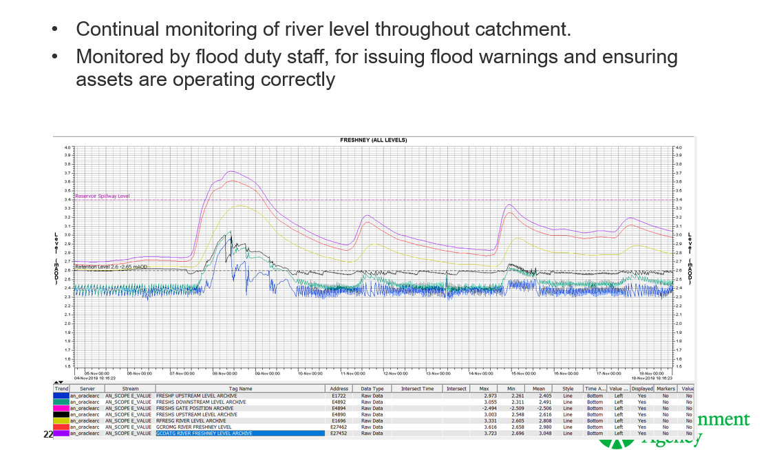
Current EA projects are along the right bank between Duke of York Gardens’ footbridge to replace rotten timbers and damaged wall joints with revetments (sloping structures to absorb and dissipate energy of water and therefore reduce erosion). Any future projects are identified through Annual Asset Inspection, CCTV Survey, Detailed Asset Inspection and Annual Reservoir Inspections..
Maintenance
EA carry out Routine Maintenance which includes:
|
River Freshney
|
New Cut Drain
|
Topics discussed:
Water quality monitoring is by a specific environmental team; water quality readings are available online and we were assured that the River Freshney is a ‘clean river and not polluted'.
Disappointingly for the audience we didn’t get more information about water quality in view of the fact that only in May, Cleethorpes beach was not awarded the prestigious Blue Flag status for the first time in many years (something which needed North East Lincolnshire Council to apply for but didn’t due to issues with water quality).
Silt levels claimed by audience members to be 4-5ft in places and therefore a danger to children. EA: Silt levels are not considered to be a factor towards flooding. Safety and access to rivers are the responsibility of the landowner.
Future projects EA still has to bid for monies from central government (proposed projects being decided through Annual Asset Inspection however, EA still has to bid for money for each project identified – added to this is the problem caused by the pandemic: money is reduced. Even so, time is spent deciding on future works and how to bid for the funds to carry them out.
[1] Permissive Powers
Coastal protection authorities (ie district and unitary authorities in coastal areas) and the Environment
Agency have permissive powers to protect against coastal flooding and to carry out erosion defence works. However, this is not a legal obligation – merely ‘the power to’ carry out protection works, not a duty to and will not be liable for the failure to exercise these powers.
In effect, action will be taken only where there is a clear economic benefit and effective use of tax-payers money, /or an appropriate engineering solution that is achievable, and where environmental legislation is not contravened. Landowners have ultimate responsibility for protecting their own property from flooding and erosion but must act within statutory planning regulations.
.
[2] A riparian landowner is the owner of land that is next to a watercourse or has a watercourse running through or beneath it. Riparian landowners have discrete legal rights and responsibilities in relation to the watercourse and its banks. These include: Fishing rights unless these are owned by another person. A watercourse can be a river, brook, beck, ditch, stream or culvert.
GCDCS thank Environment Agency for permission to reproduce some of their presentation slide material. Other mages are by Sue Milsom, GCDCS
Further reading:
A search of http://www.environmentlaw.org.uk (UK Environmental Law Association) finds:
- The Environment Agency (EA) is responsible for dealing with water pollution incidents in England
- The Water Industry Act 1991 requires local authorities to monitor the wholesomeness and adequacy of water supplies within their areas. With many ‘local authorities routinely conduct sampling programmes of main supplies to determine if the supplies are safe for consumption and recreation.’
- The Drinking Water Inspectorate (DWI) is responsible for regulating the quality of drinking water supplies
15th February 2022 River Freshney water quality project completes :‘Work finished last week on a key project to improve the water quality of the River Freshney in Grimsby Town Centre with more than 2230 tonnes of silt removed from the riverbed over four weeks.’
https://www.nelincs.gov.uk/river-freshney-water-quality-project-completes/
Water Quality
http://environment.data.gov.uk/data/bathing-water-profile/uke1301-09000/2020:1.html
https://environment.data.gov.uk/bwq/profiles/
https://environment.data.gov.uk/water-quality/view/explore
SM

